11/7/2022
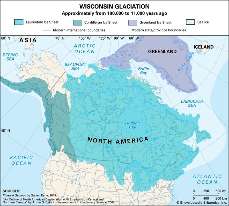
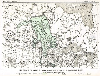
Looking northwest from Lake Superior, a collection of large lakes shows up in the straight-line path towards the Great Bear Lake. These lakes are within the province of present-day Manitoba and include among others, Lakes Winnipeg, Winnipegosis, and Manitoba. They are not impact sites but rather shallow Lakes that lie east of an escarpment near the Manitoba/Saskatchewan border. These are the remnants of a huge lake from glacier times and existed around 12,000 years ago. Lake Agassiz was the name of this massive body of water that was larger than all the Great Lakes combined. It was long term glacierization that finished off today’s shorelines and scenery in the regions of the impacts. Lake Agassiz was formed by glacier blockage in the region and its inability to drain to the north. Other outlets released large amounts of water south to the Gulf of Mexico and east to the Atlantic through the giant river known today as Lake Erie. It fell over another escarpment that was above the meteor impacted 802′ deep: Lake Ontario, and found its way to the Atlantic Ocean via the reasonably straight St. Lawrence River. Most rivers meander in a ratio near the number pi, however due to the large volume of melting waters of the glaciers during their presence, the fast-moving waters created a straight canyon on its path eastward. Glaciers are the key to many mysteries. If a large crater is present in an area and weather patterns create long cold winters, snow begins to accumulate and, over time, moves downhill. These glaciers will travel where the terrain drops. Scouring occurs on rock surfaces as it moves downhill. The evidence of glacier scour marks on the bottoms of the Great Lakes is from the fact that the hole was there first and that the bulldozering glaciers did not dig out the Great Lakes. If it did, giant piles of gravel, rock and debris would be in northern Indiana. It is dead flat there, except for some small sand dunes at Indiana Dunes National Park.